Wedding Infrastructure Desert Map
Updated • Published
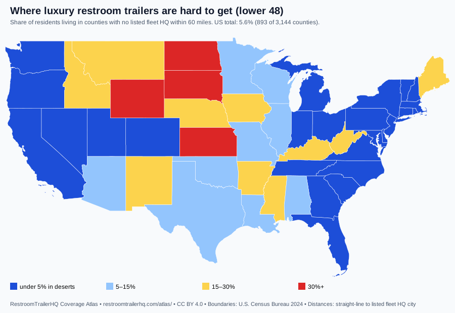
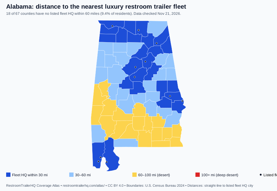
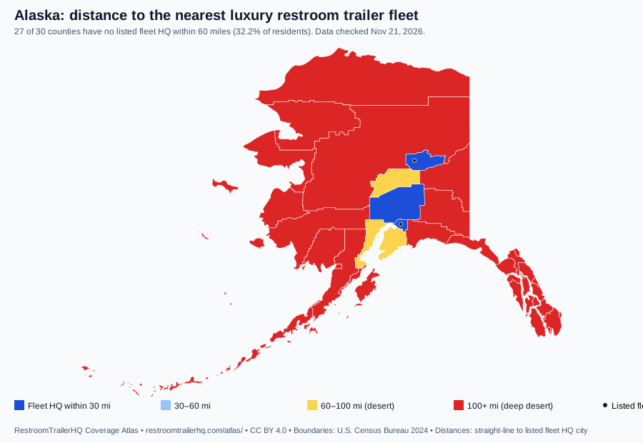
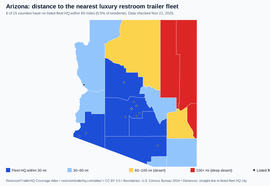
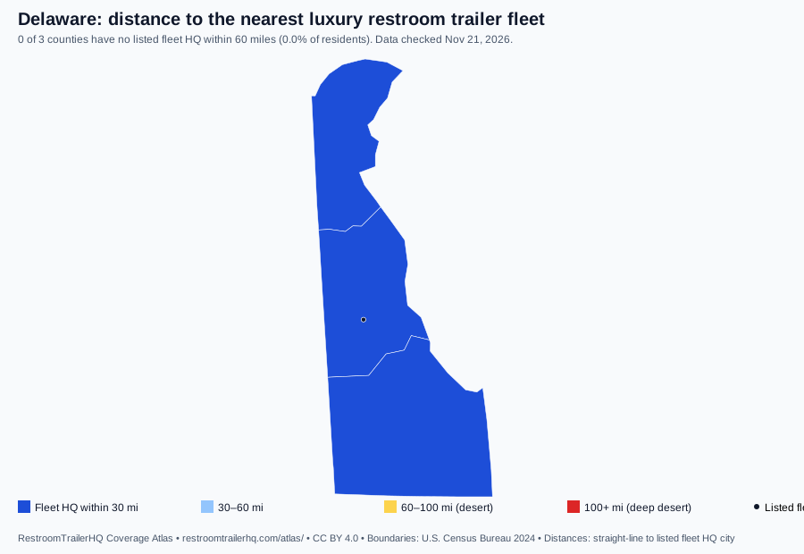
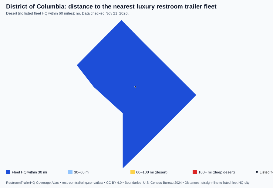
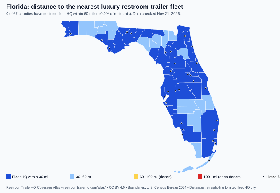
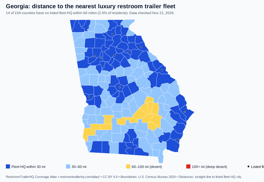
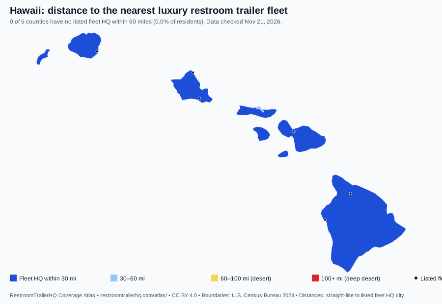
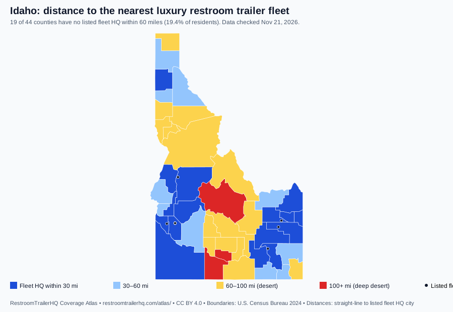
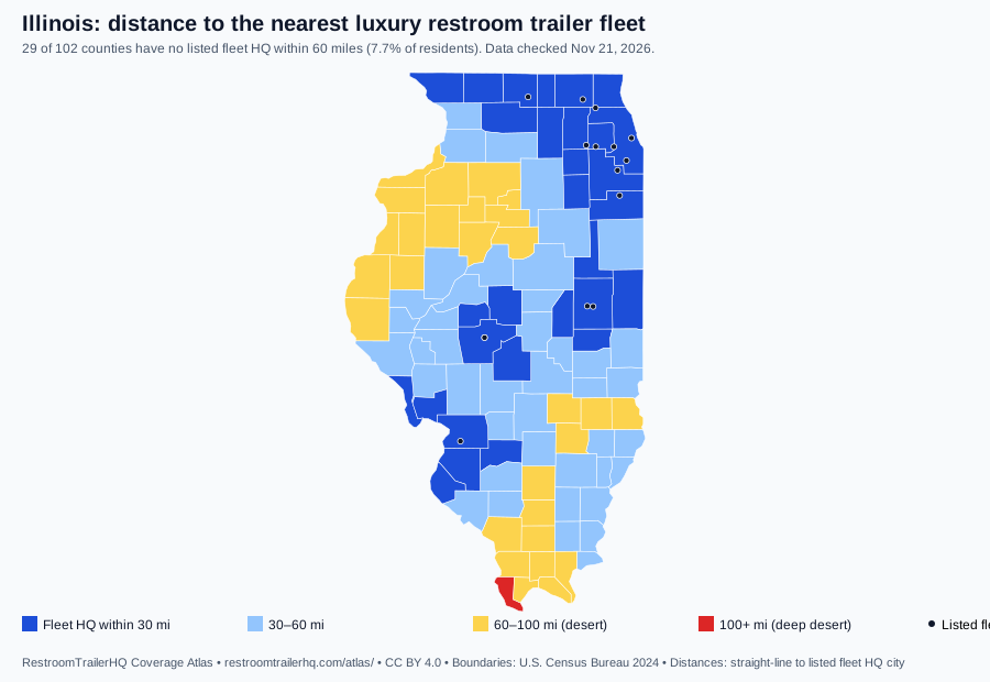
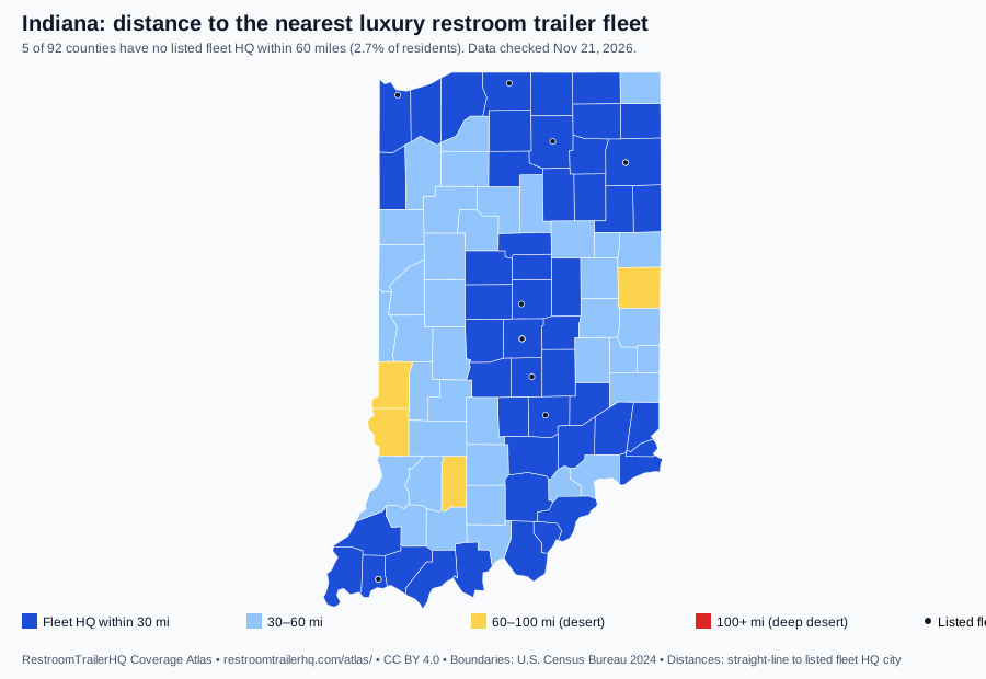
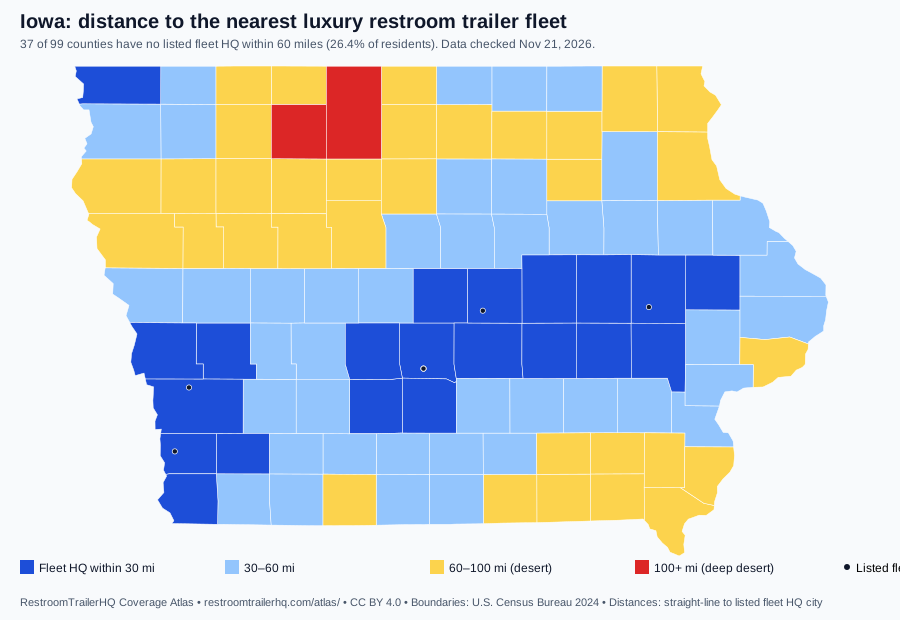
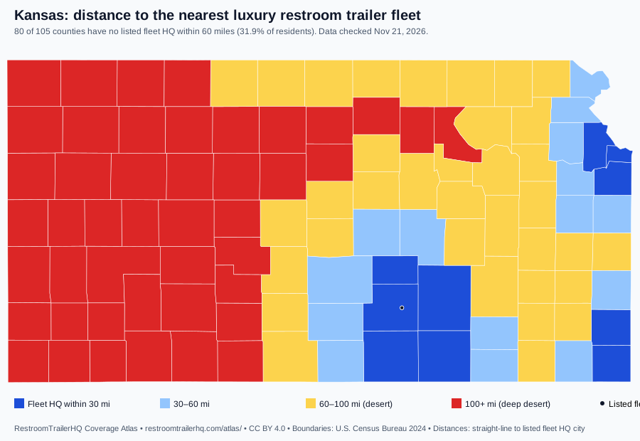
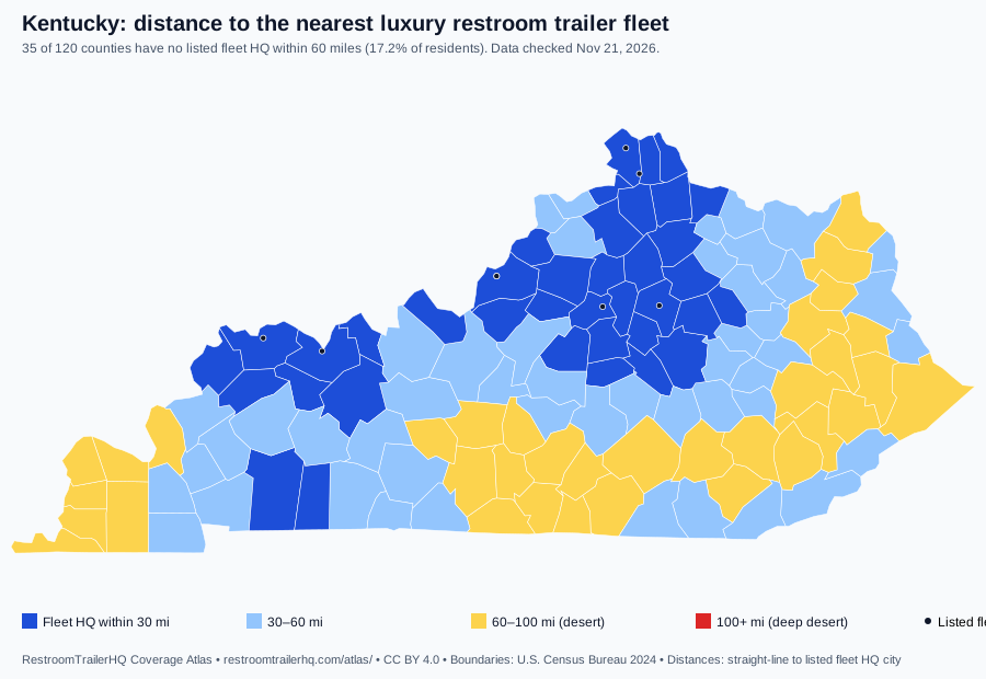
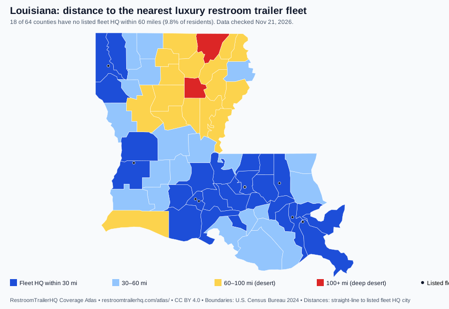
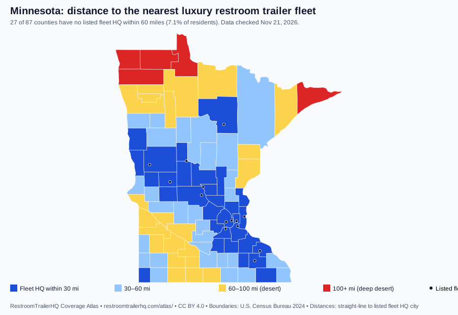
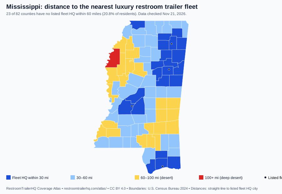
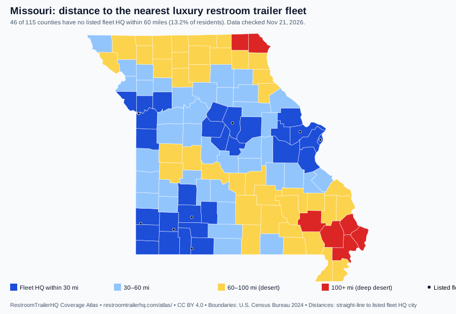
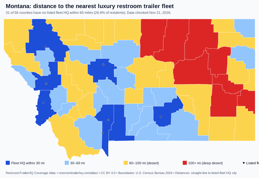
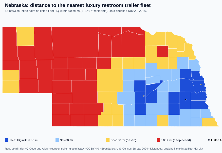
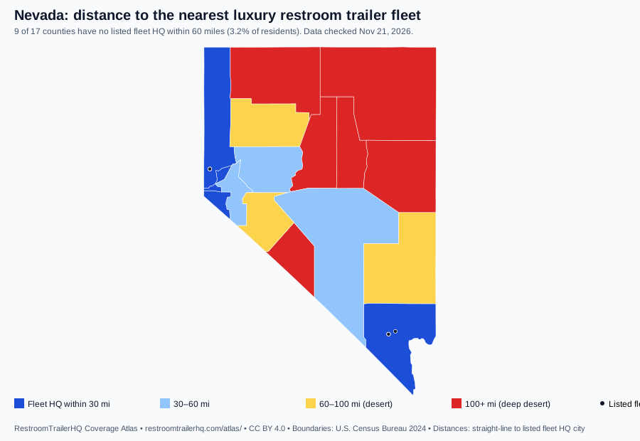
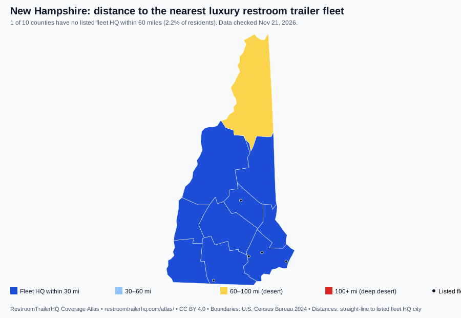
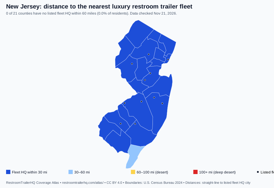
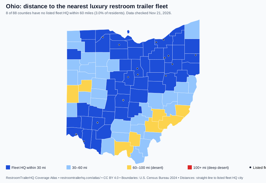
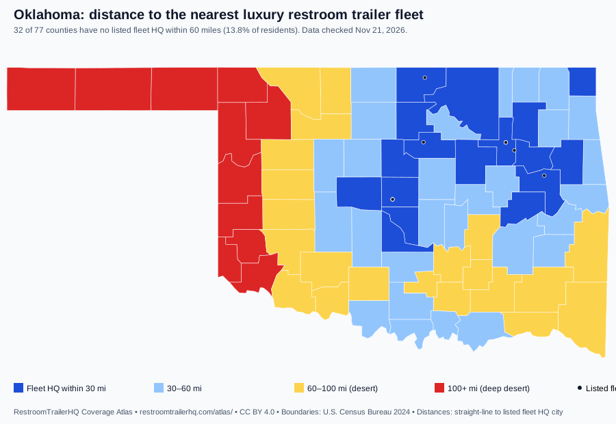
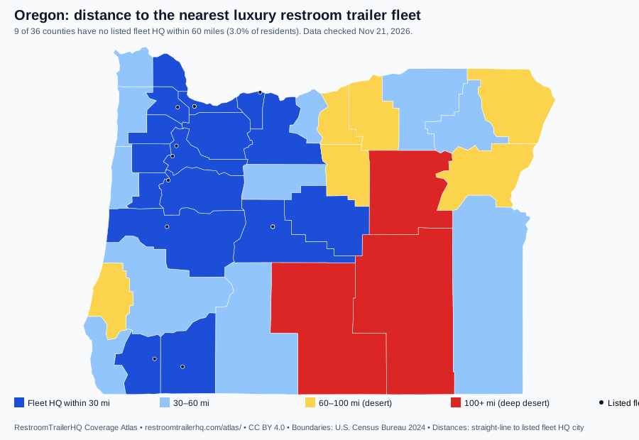
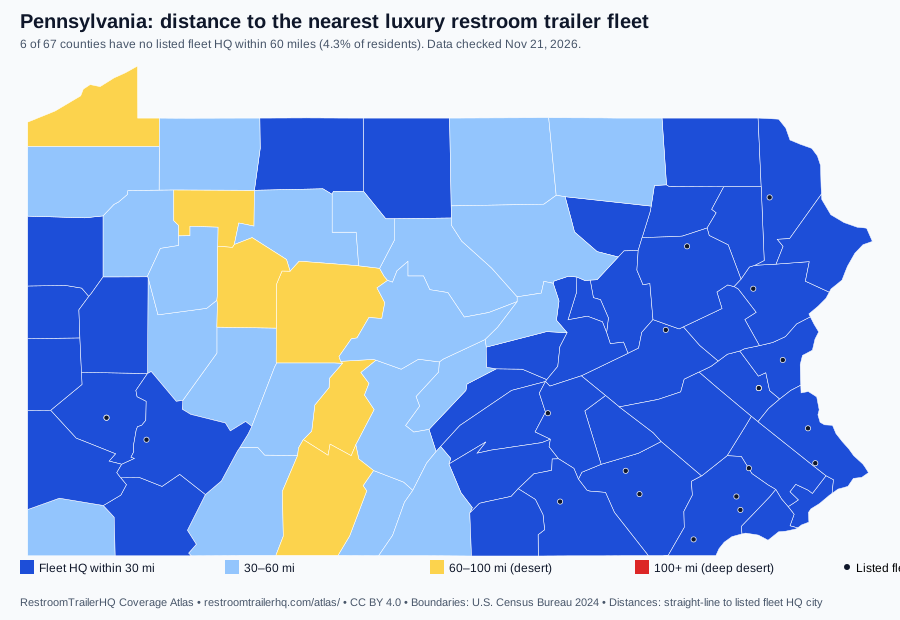
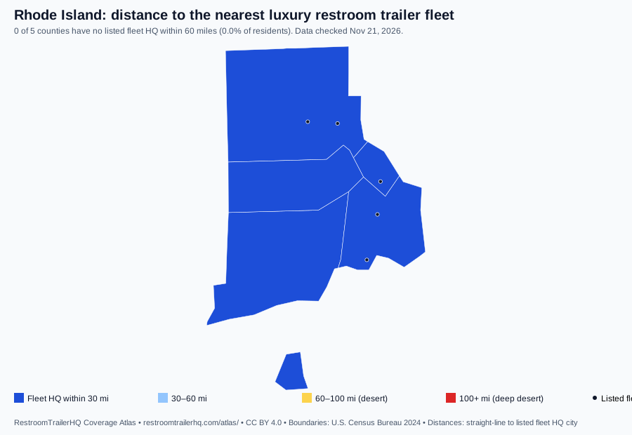
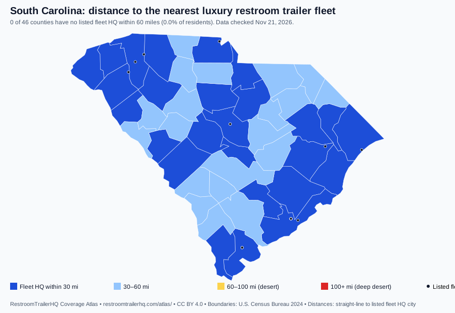
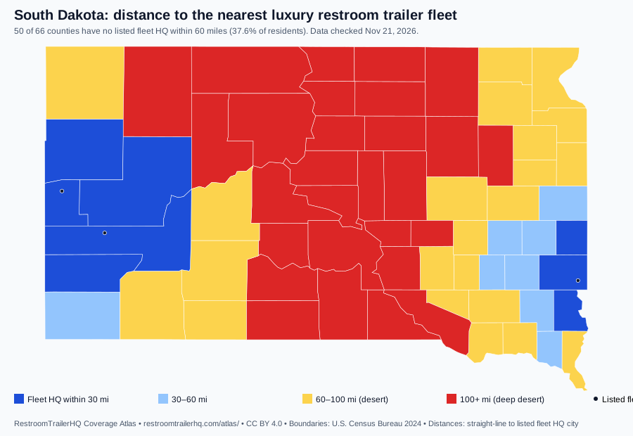
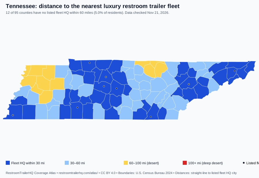
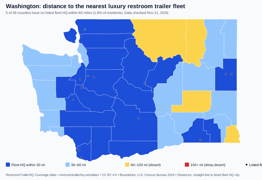
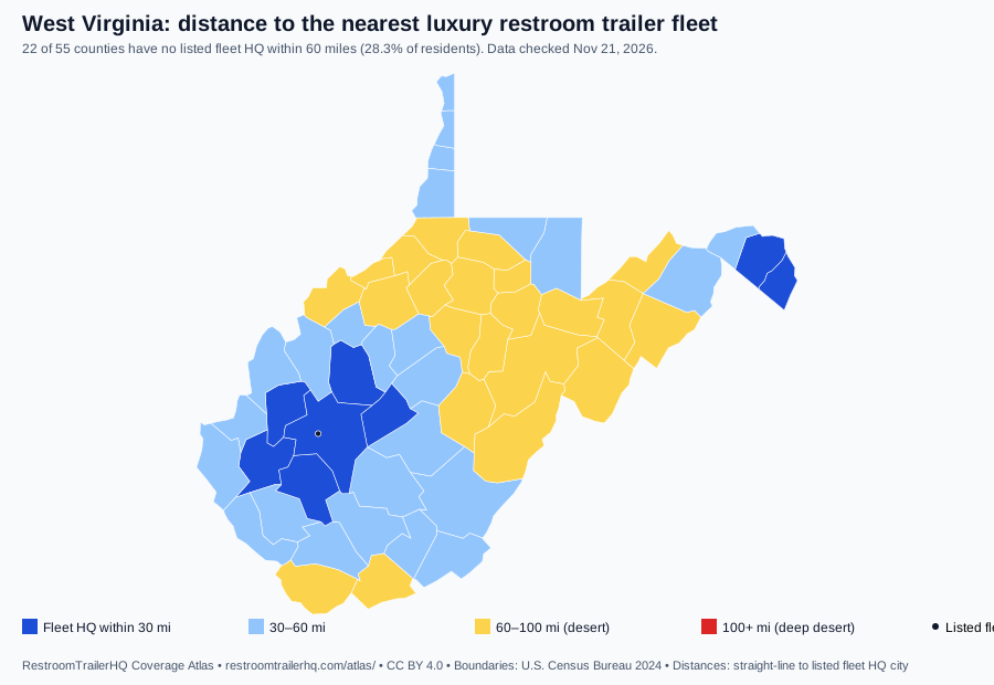
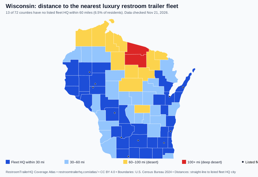
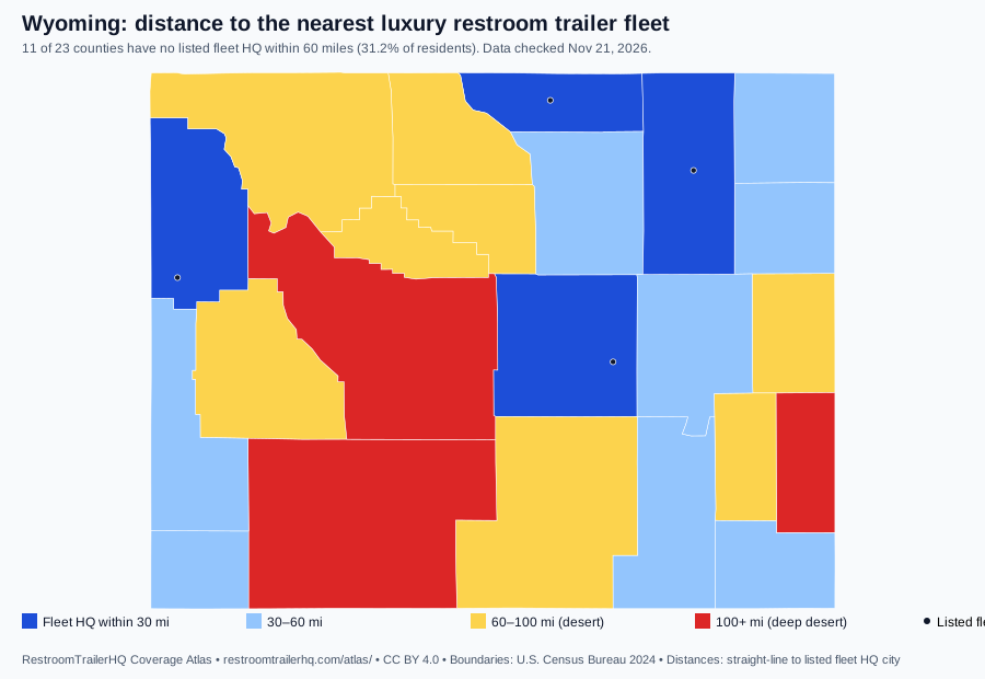
Where is it hard to get a luxury restroom trailer? 5.6% of US residents (893 of 3,144 counties) live in a county with no listed fleet headquarters within 60 miles, measured from each county's 2020 Census center of population to the nearest listed fleet's HQ city. This free map shows it county by county for any state or any of our 50 wedding corridors, with 2024 state marriage rates from CDC/NCHS, on OpenStreetMap tiles with US Census boundaries. It is the embeddable version of the Wedding Infrastructure layer on our Coverage Atlas; state maps download as SVG or PNG and the county join table as CSV, all CC BY 4.0.
Try it
Embed code
Paste this into any HTML block (WordPress Custom HTML, Squarespace Code, Wix Embed, Webflow Embed).
";One state: add ?state=TX&lock=1 to the iframe src. One wedding corridor: ?corridor=texas-hill-country-dripping-springs-tx (slugs below).
Embed a wedding corridor
Each corridor view zooms to the corridor and counts how many of its venue counties are deserts. Venue names are not shown. Read the study.
Downloads (CC BY 4.0)
Credit "RestroomTrailerHQ" with a link to https://restroomtrailerhq.com/atlas/. County join table (CSV): desert flag, miles, population, state marriage rate, guide venues per county. National: US SVG • PNG. PNGs are drawn in your browser from the SVG.
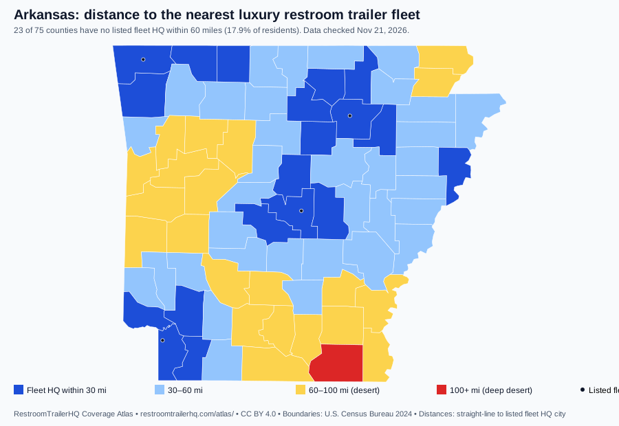
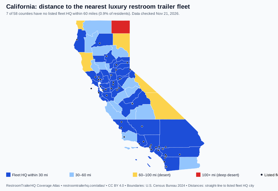
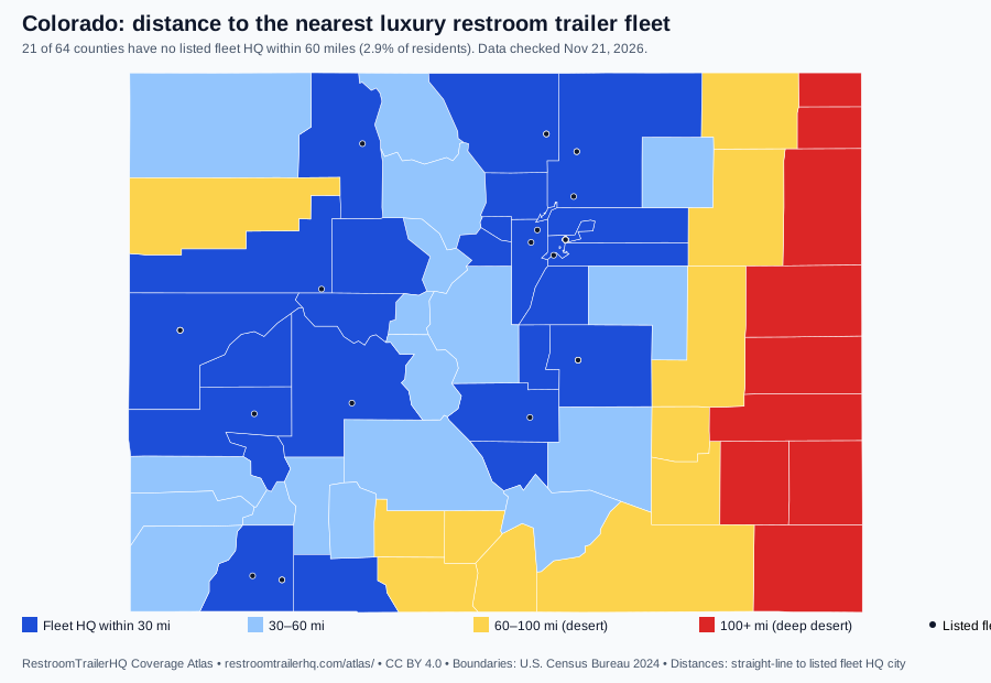
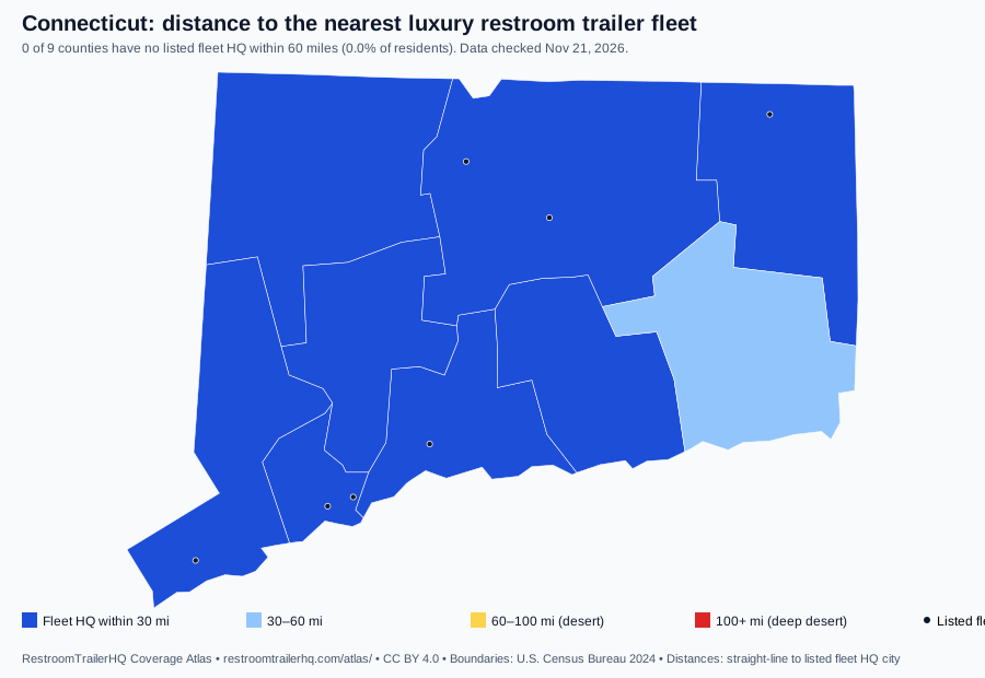
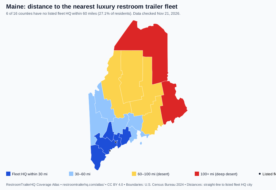
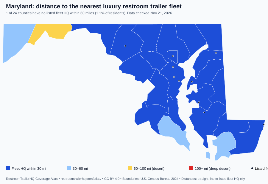
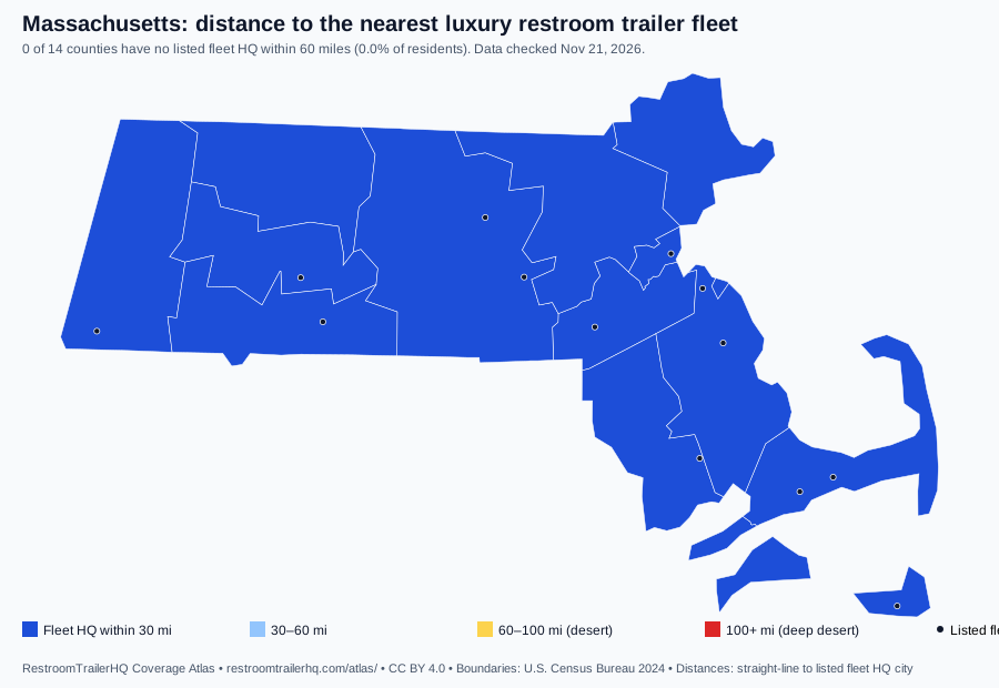
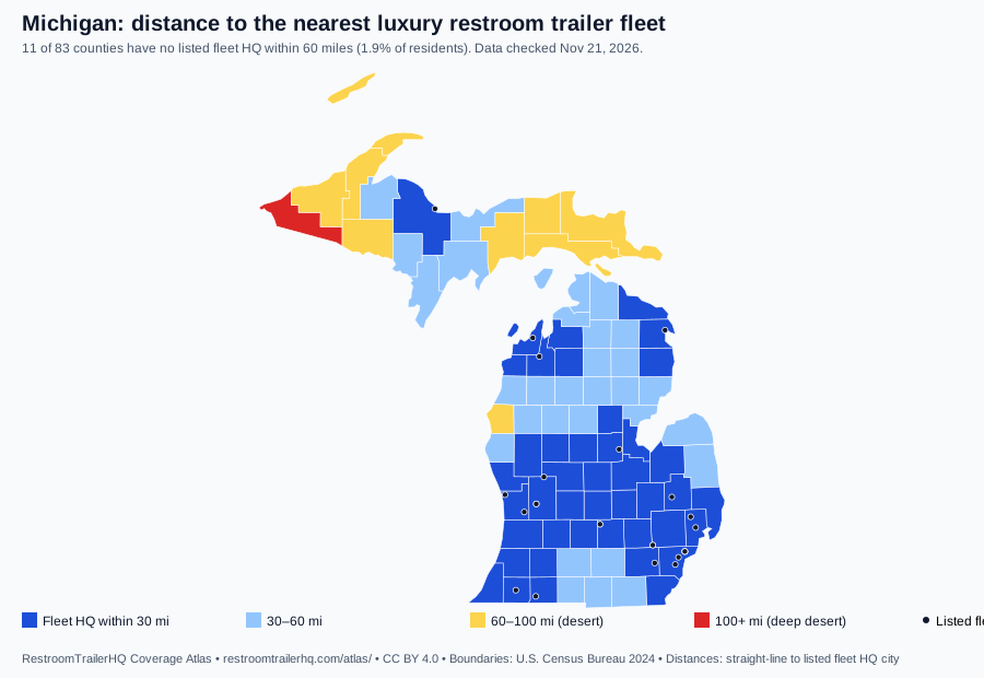
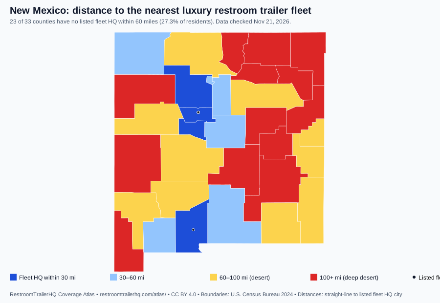
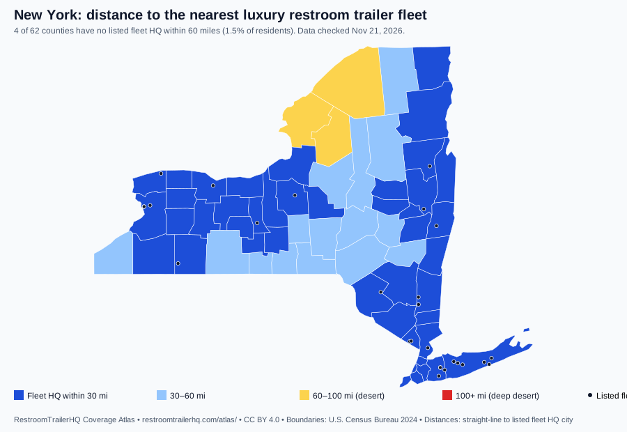
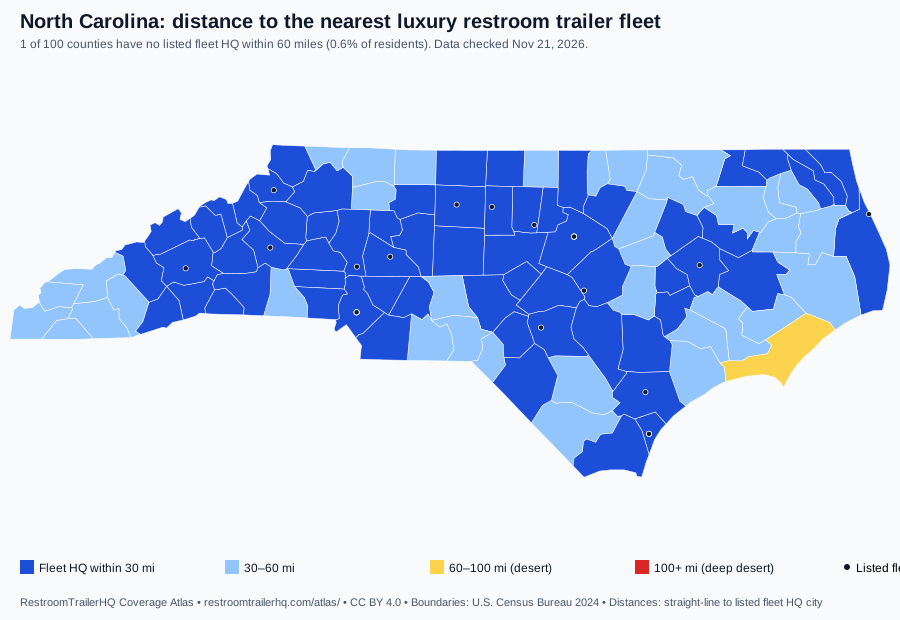
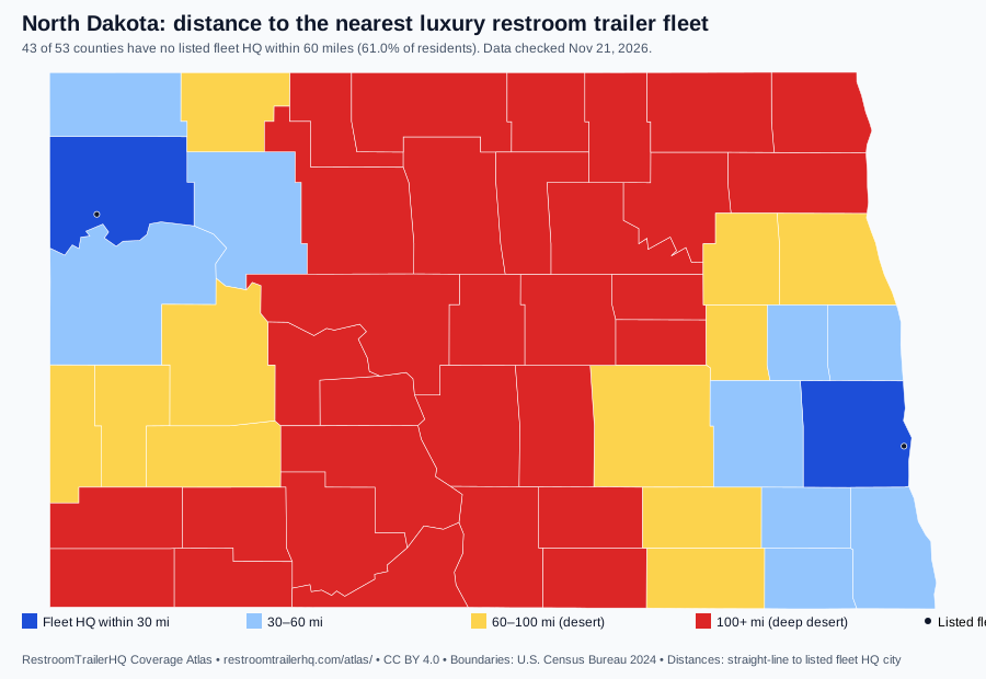
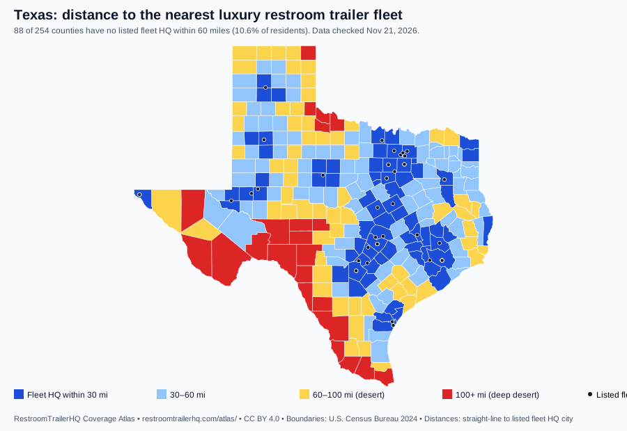
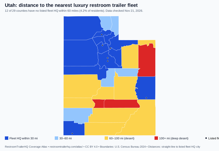
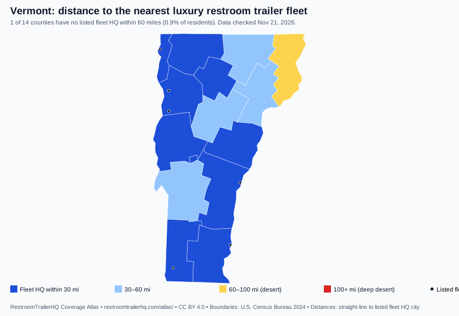
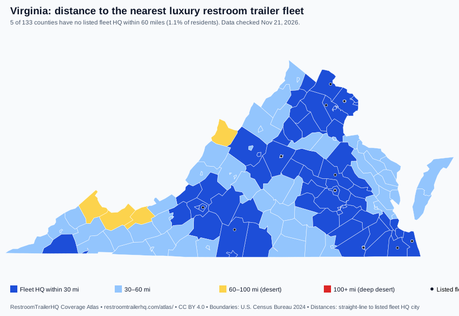
WordPress? Use the free plugin instead.
How it works
- Each county's point is its 2020 Census mean center of population (Connecticut: 2024 planning-region internal point).
- Distance is straight-line to the nearest listed fleet's HQ city centroid; fleets often travel farther, for a fee.
- Desert = no listed fleet HQ within 60 miles. Classes: ≤30, 30–60, 60–100 and 100+ miles.
- Boundaries: U.S. Census Bureau 2024 cartographic boundary files (1:20m). Map tiles: © OpenStreetMap contributors.
- Purple dots: our 50 wedding corridor guides (placed at the average of their venues' town centers); venue names are not shown.
- State marriage rates: CDC/NCHS, 2024 provisional, per 1,000 residents, by state of occurrence. Annual and statewide only.
- Same data as the Coverage Atlas CSV and GeoJSON (CC BY 4.0); full method at /atlas/methods/.
Sources
- U.S. Census Bureau cartographic boundary files 2024 (counties, states, 1:20m)
- RestroomTrailerHQ Coverage Atlas data (CSV)
- CDC/NCHS National Vital Statistics System: marriage rates by state, 1990, 1995, 2000–2024
Who uses it
Local news and data journalists, county tourism and economic development offices, rural venues, event associations, and fleets looking for expansion markets.
FAQ
Is it free?
Yes. No account, no fee, no ads. We ask you to keep the small 'by RestroomTrailerHQ' credit line under the widget; you may remove it.
Does it collect visitor data?
The widget has no forms and asks for no personal details. Like every page on our site it logs an anonymous page view, and your site's name can be passed as ?ref= so we can see where it is used.
Will it slow my page down?
No. It loads in a lazy iframe after the visitor scrolls to it, and the optional resize script is under 1 KB.
Terms
Free for any site, commercial or not. Results are planning estimates, not quotes or legal advice. Please keep the credit line; you may remove it. Data: CC BY 4.0. Questions: bob@restroomtrailerhq.com.
More: all free widgets • open data API & MCP • methods